UN
38 Higham Close
£ 167,000
Description
We don't have a Description for this property.
- Bedrooms
- 3
- Bathrooms
- 0
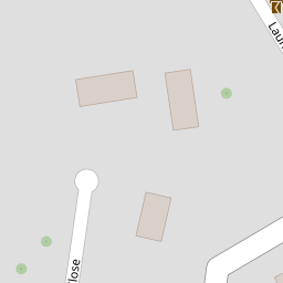
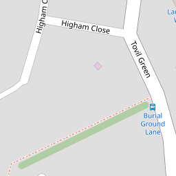

Leaflet © OpenStreetMap contributors
The heatmap indicates the level of crime in the area. The color of the heatmap indicates the crime severity and recency.
Metrics Year-on-Year
- Average area value
- 269,233.00 £Increased by 4.58 %
- Average area rental value
- 1,197.00 £/moDecreased by 2.52 %
- Est rental Yield
- 5.34 %Decreased by 6.64 %
- Crime Rate
- 3.00 %Unchanged by 0.00 %
from 257,448.00 £
from 1,228.00 £/mo
from 5.72 %
from 3.00 %
Nearby Schools
| Name | Type | Ofsted | Distance |
|---|---|---|---|
| Maidstone, St Michael'S Church Of England Junior School | Voluntary Controlled School | Good | 0.63 KM |
| St Michael'S Church Of England Infant School Maidstone | Voluntary Controlled School | Outstanding | 0.63 KM |
| Oneschool Global Uk - Maidstone Campus | Other Independent School | 0.79 KM | |
| Archbishop Courtenay Primary School | Academy Sponsor Led | Requires improvement | 0.99 KM |
| Maidstone And Malling Alternative Provision | Pupil Referral Unit | Good | 1.11 KM |
Images
Nearby Streets
| Name | Average Price | Average Sqft | Distance |
|---|---|---|---|
| Lower Tovil | £ 0 | 0 | 0.00 KM |
| Wharf Road | £ 0 | 0 | 0.00 KM |
| Rosemount Close | £ 1,066,667 | 0 | 0.00 KM |
| St Michael's Road | £ 462,500 | 0 | 0.00 KM |
| Orchard Place | £ 0 | 0 | 0.00 KM |
Nearby Transport
| Name | NLC | TLC | Distance |
|---|---|---|---|
| Maidstone West | 5222 | MDW | 1.18 KM |
| Maidstone Barracks | 5237 | MDB | 1.64 KM |
| Maidstone East | 5115 | MDE | 2.18 KM |
| East Farleigh | 5234 | EFL | 2.68 KM |
| Barming | 5133 | BMG | 3.91 KM |
Nearby Listings
| Address | Price | Type | Score | Distance |
|---|---|---|---|---|
| Higham Close, MAIDSTONE, Kent, ME15 | £ 300,000 | BUY | Unknown | 0.00 KM |
| Bridge Mill Way, Tovil, Maidstone | £ 325,000 | BUY | 6 / 10 | 0.06 KM |
| Higham Close, Maidstone, Kent, ME15 | £ 310,000 | BUY | Unknown | 0.07 KM |
| Higham Close, Maidstone | £ 345,000 | BUY | Unknown | 0.12 KM |
| The Stampers, Maidstone, ME15 | £ 300,000 | BUY | 6 / 10 | 0.14 KM |
Nearby Properties
| Address | Price | Distance |
|---|---|---|
| 42 Higham Close | £ 190,000 | 0.00 KM |
| 38 Higham Close | £ 167,000 | 0.00 KM |
| 12 Higham Close | £ 160,000 | 0.00 KM |
| 10 Higham Close | £ 160,000 | 0.00 KM |
| 36 Higham Close | £ 210,000 | 0.00 KM |